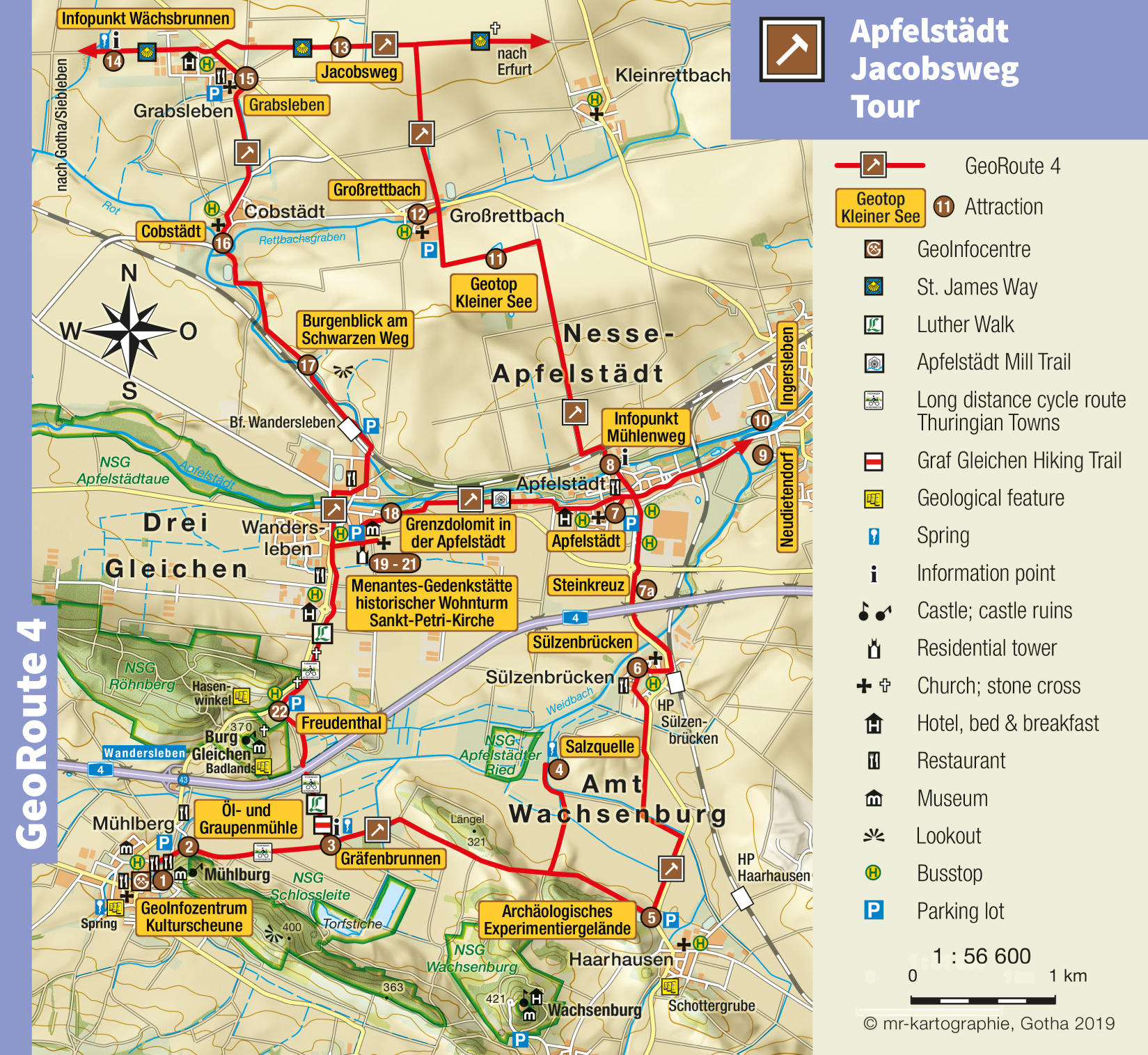

Apfelstädt Jacobsweg Tour
GeoRoute 4
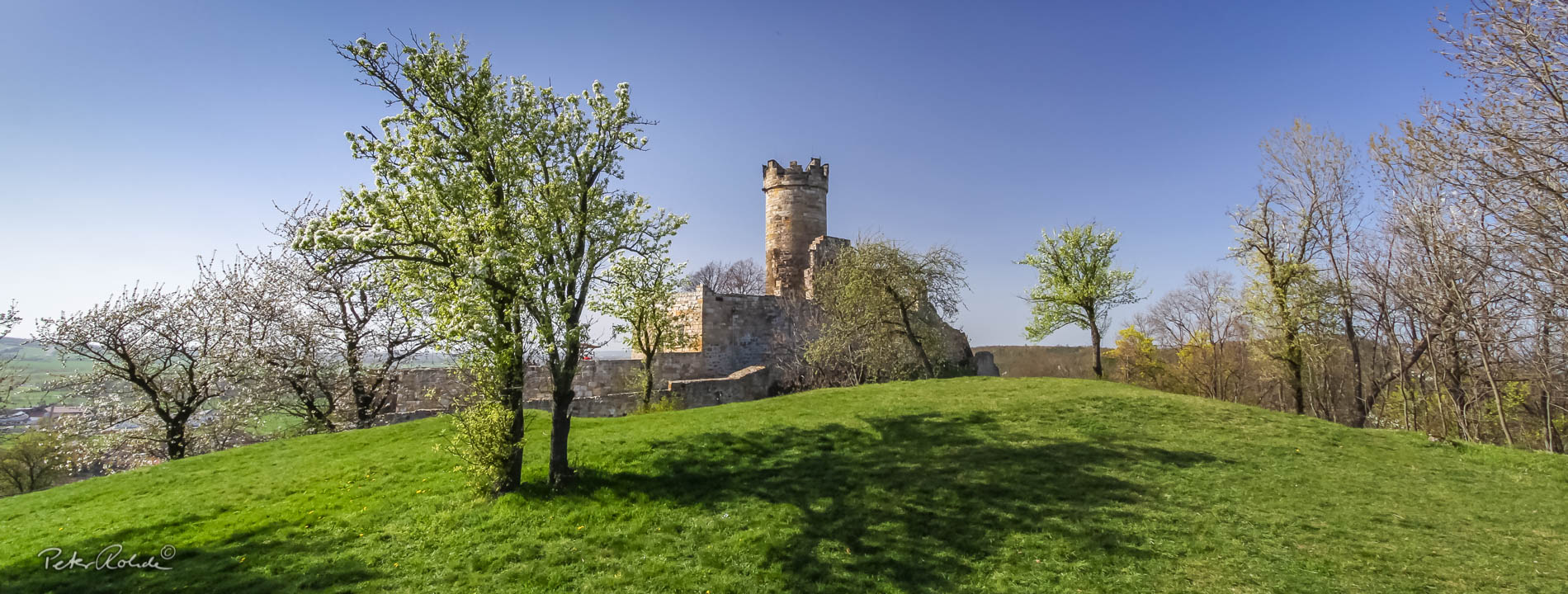
The Apfelstädt Jakobsweg Tour connects an ancient King's road (via regia) with the Drei Gleichen region. Today the old trade road is part of the pilgramage route St. James way. The Georoute begins at the GeoInfocentre Kulturscheune Mühlberg, passes the Gräfenbrunnen spring to the Salzquelle (Brine Spring) and the sinkholes Kleiner See to the springs Maternbrunnen and Wächsbrunnen. Between Wandersleben and Apfelstädt you will come upon the very interesting exposure of the boundary dolomite (Grenzdolomit) in the Apfelstädt. The experimental archaeology site in Haarhausen as well as the Menantes Memorial and the residential tower in Wandersleben add to the attractions of this route. This route connects the villages Mühlberg, Haarhausen, Sülzenbrücken, Apfelstädt, Großrettbach, Grabsleben, Cobstädt and Wandersleben.
- Distance / Category: approx. 35 km, Bicycle circuit (north loop approx. 17 km, south loop approx. 18 km)
- Elevation: approx. 200 – 300 m above sea-level
- Difficulty: moderate
- Trail characteristics: Asphalt, waterbound roads, field roads
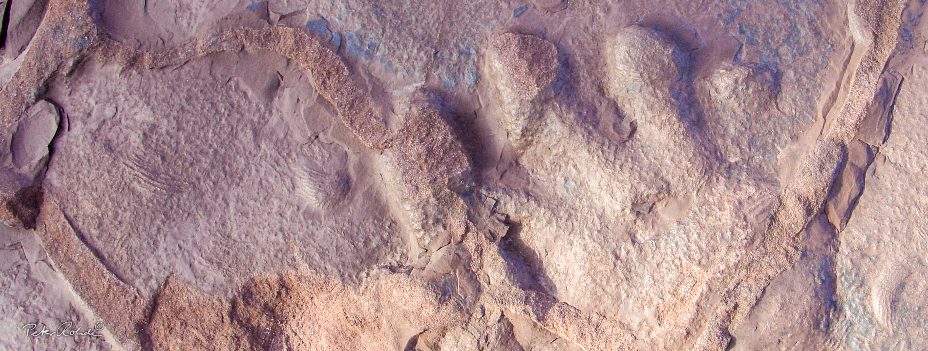
- Geological stations: Boundary dolomite, a 2 to 4 m thick and about 230 million year old dolomite bed in the river bed of the, Apfelstädt (near Wandersleben) • “Gräfenbrunnen“ (Mühlberg) • brine spring (near Sülzenbrücken) • Experimental Archaeology site Haarhausen (reconstruction of a Roman potters from the 3rd century) • Geotope Kleiner See (Grossrettbach)
- Touristic stations: Wandersleben: Castle Gleichen, Menantes-Literature Monument, Mühlberg: Mühlburg Castle, Sankt-Lukas-Church, Ingersleben: local history museum, natural stone arched bridge over the Apfelstädt (built 1751/52), Neudietendorf: Krügervilla & Krügerpark, Cobstädt: Visitor’s Garden of the Lebensgut Cobstädt e. V.
- Information: Tourist Information and GeoInfocentre “Kulturscheune“
Text: Bettina Aschenbrenner (PhD), Tourismusverband Thüringer Wald Gothaer Land e.V.